
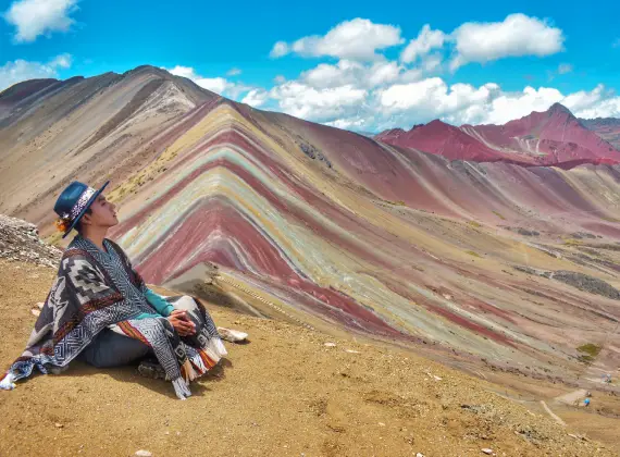
FULL DAY · SMALL GROUP

VINICUNCA · HIGH-ALTITUDE CHOICE
Rainbow Mountain Tours
Compare three real ways to experience Vinicunca and Red Valley. Altitude and difficulty matter more than the color of the photograph.
- Altitude
- Vinicunca · 5,000 m+
- Difficulty
- High altitude changes the effort
- Core choice
- Full Day or 2 Day
THE EXPERIENCE
AT 5,000 M, PREPARATION COMES FIRST.
Mineral-rich bands create the mountain’s colors. Light and weather change what you see; no photo guarantees the conditions on your travel day.
CHOOSE WITH CLARITY
Which journey fits you?
Choose a Full Day small-group route, a private Full Day experience with Red Valley, or a separate 2 Day Ausangate journey.
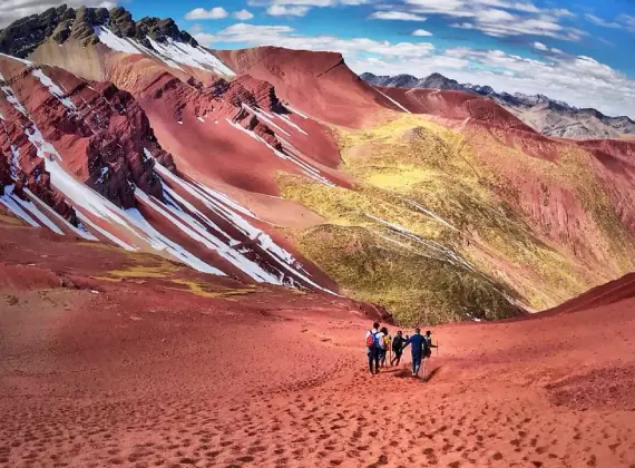
FULL DAY · PRIVATE + RED VALLEY
Full Day Rainbow Mountain and Red Valley – Private Service
View the published tour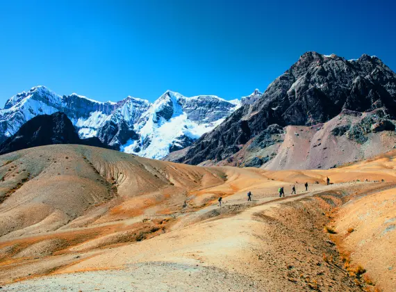
ROUTE ORIENTATION
Understand the route.
These products approach the high-altitude Rainbow Mountain area differently. The 2 Day Ausangate route is not a longer copy of a Full Day walk.
ROUTE 01 · KEY-POINT PROFILE
FULL DAY · SMALL GROUP
Full Day small group: Vinicunca focus; see the published route and walking conditions.
SCHEMATIC ELEVATION · NAMED POINTS ONLY
- DAY 1 · VANCusipata10,922 ft (3,329 m)
- DAY 1 · HIKETrail elevation12,762 ft (3,890 m)
- DAY 1 · HIKEVinicunca16,470 ft (5,020 m)
The published day route reaches Vinicunca at about 5,020 m; this is high-altitude travel, even if the walking distance looks short.
Read the exact itineraryROUTE 02 · KEY-POINT PROFILE
FULL DAY · PRIVATE + RED VALLEY
Full Day private: Vinicunca with Red Valley; consult its distinct itinerary.
SCHEMATIC ELEVATION · NAMED POINTS ONLY
- DAY 1 · VANCusipata10,922 ft (3,329 m)
- DAY 1 · HIKETrail elevation12,762 ft (3,890 m)
- DAY 1 · HIKEVinicunca16,470 ft (5,020 m)
- DAY 1 · HIKERed Valley
The private itinerary continues toward Red Valley after Vinicunca; Red Valley's elevation is not assigned without a product-specific source.
Read the exact itineraryROUTE 03 · CONCEPTUAL ROUTE
2 DAYS · AUSANGATE
2 Day Ausangate: a separate multi-day route through the high-altitude area.
SCHEMATIC ROUTE · NO NUMERIC ELEVATION PROFILE
- DAY 1 · HIKEAusangate / Pucaccocha
- DAY 1 · HIKEAnanta camp
- DAY 2 · HIKERainbow Mountain
- DAY 2 · HIKERed Valley
A separate high-altitude Ausangate-area journey with an overnight near Ananta. The published day-by-day maxima differ, so verify the exact elevations before booking.
Read the exact itineraryALTITUDE · EFFORT · REALITY
Altitude comes first.
Vinicunca is a destination above 5,000 m. Exact route maxima and walking demands differ by product; read the chosen itinerary rather than applying one number to all three.
THE ROUTE IN FOCUS
What makes this place distinct.
See what sets these journeys apart, then open the tour that matches your time and interests.

01
Altitude first
This is a high-altitude outing. Compare your acclimatization and the specific route demands before choosing.
02
Color and conditions
The mineral bands are real, but cloud, rain and light influence visibility and the photographic result.
BEFORE YOU GO
Plan for the route you choose.
Acclimatization, layers, rain protection and sun protection matter. Visibility changes quickly; the mountain may look different from edited photographs.
PRACTICAL ANSWERS
Before you decide.
Altitude first
This is a high-altitude outing. Compare your acclimatization and the specific route demands before choosing.
Color and conditions
The mineral bands are real, but cloud, rain and light influence visibility and the photographic result.